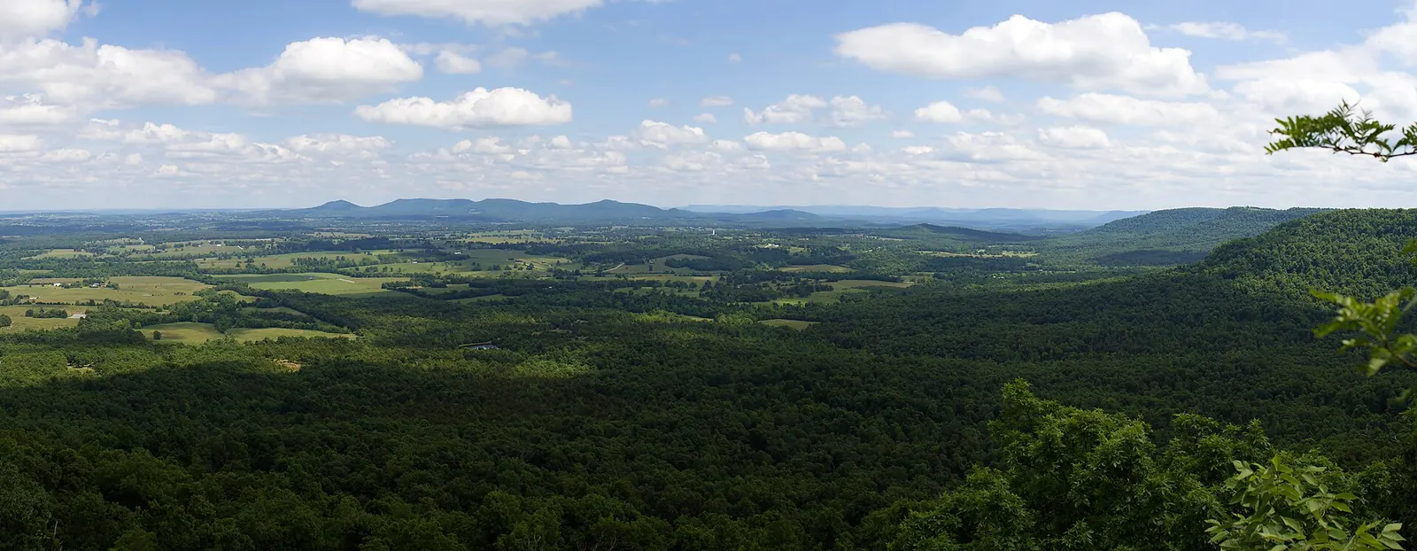

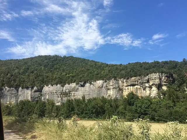
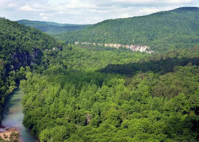
The Arkansas Grand Canyon formed as streams cut into the nearly flat rock layers of the Boston Mountains, leaving ridges, cliffs and deep valleys 1,2,3,4. The landscape seen from Scenic Highway 7 south of Jasper belongs to the western Big Creek drainage, not to the Buffalo River's main channel 5,6,7,8,9. Its form reflects erosion of sandstone, shale and limestone over a very long time, rather than a fault-created rift or a collapsed cave 1,2,3,4.
A dissected plateau, not a folded mountain range
The Boston Mountains form the southern portion of the Ozark Plateau 1. The Encyclopedia of Arkansas describes their relief, the difference between valley bottoms and mountaintops, as the greatest of any landform between the Appalachian Mountains and the Rocky Mountains 1. Geologists call this landscape a dissected plateau: a high block of nearly flat-layered rock carved into ridges and valleys by streams 1,4,10. Unlike the Appalachians, the Boston Mountains are not a folded mountain range 1,4,10.
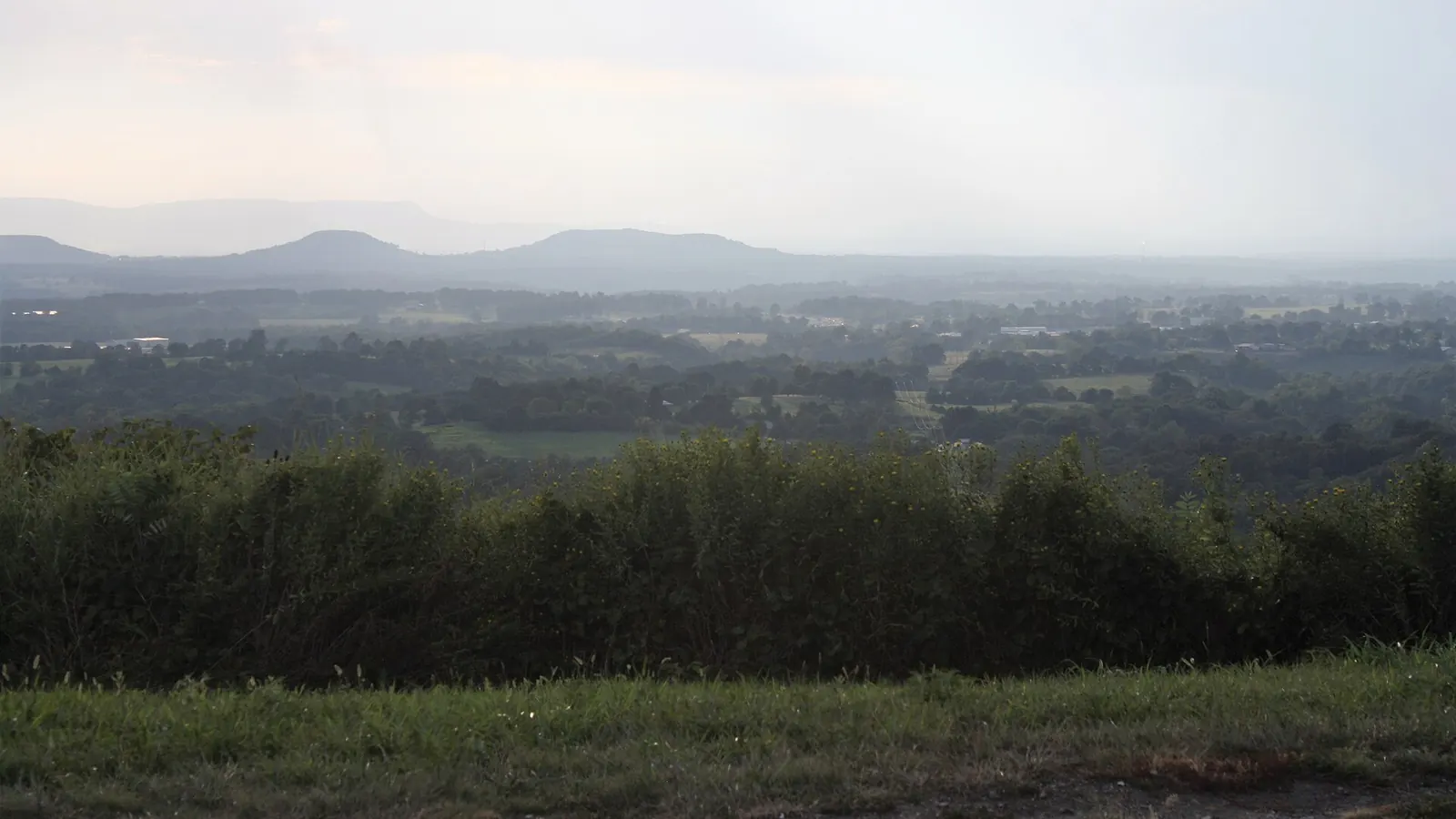

The Ozarks were last uplifted about 300 million years ago during the collision of the North American and South American continents 1. The strongest folding and faulting associated with that collision took place south of the Boston Mountains, leaving the mountain rocks here nearly flat 1. Uplift allowed streams to cut deeply into those layers 1. Resistant, flat sandstone beds cap the mountaintops, helping explain the level-looking ridgelines and cliffs that ring slopes at nearly the same height 1.
The age of this rock is not the age of the valley 1,10. Although the rocks are more than 300 million years old, the valley developed much later through erosion 1,10. Neither the uplift date nor the age of a formation supplies an exact date for the Arkansas Grand Canyon's beginning 1,10.
Which rock layers make up the Arkansas Grand Canyon?
The viewpoint landscape lies on the Boston Mountains escarpment, where resistant Pennsylvanian and Upper Mississippian rocks cap lower terrain underlain by Boone limestone 2,3. Geological maps for the Parthenon and Mount Judea quadrangles identify the following sequence, arranged with the youngest layers at the top and the oldest at the bottom 2,3.
| Rock layer, youngest at top | Geological age | Features described on the local maps |
|---|---|---|
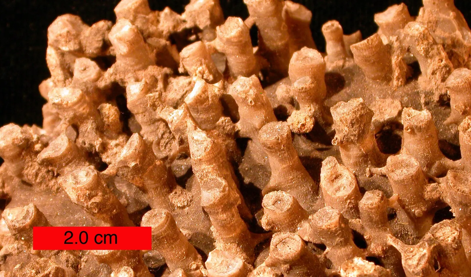
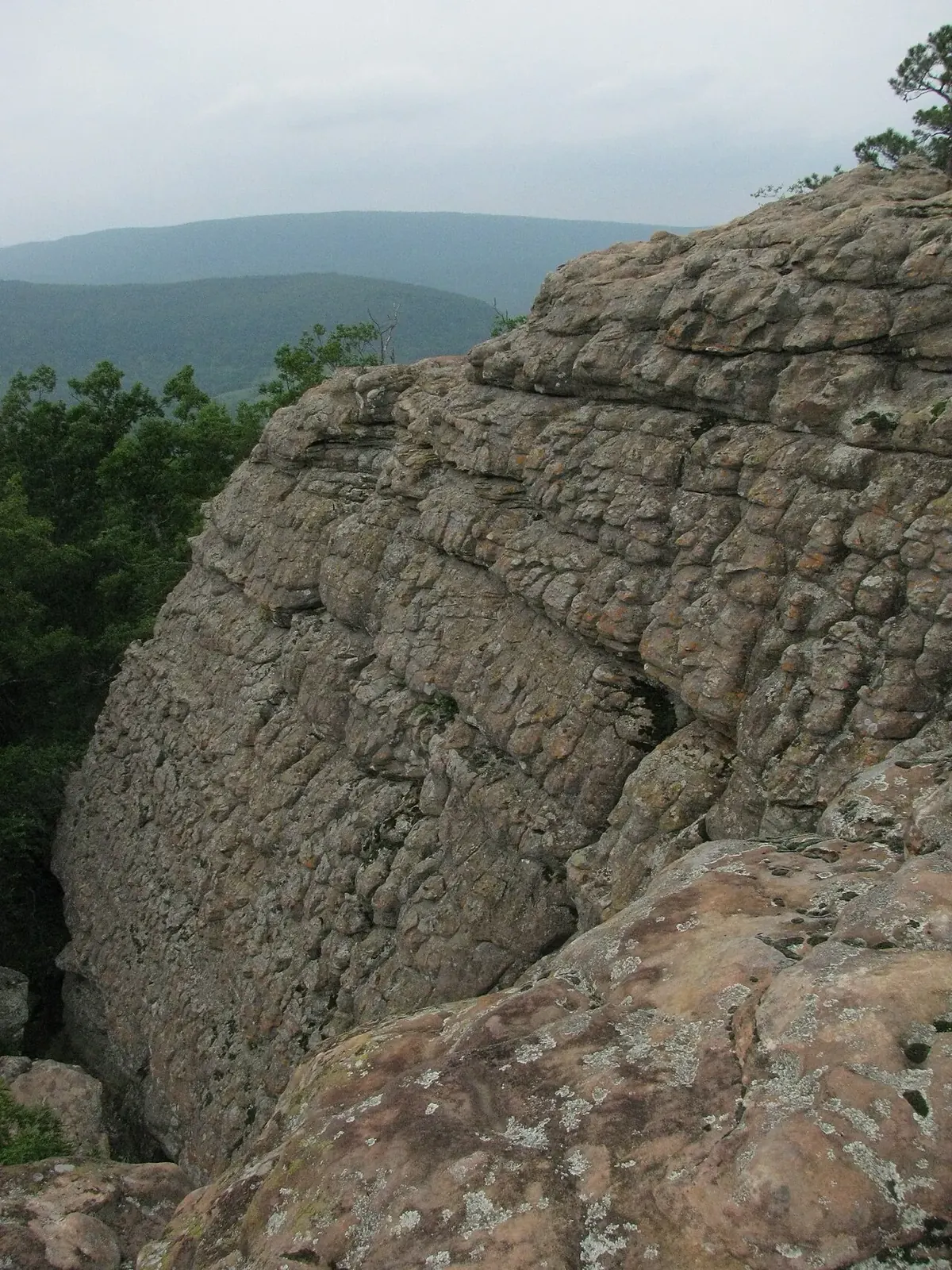
| Bloyd Formation | Lower Pennsylvanian | Middle Bloyd sandstone is a major cliff-former, with cross-bedding, quartz pebbles and plant fossils 2,3. |
| Hale Formation, including Prairie Grove and Cane Hill members | Lower Pennsylvanian | Prairie Grove sandstone forms bluffs and can show honeycomb weathering 2,3. |
| Pitkin Limestone | Mississippian | Limestone in the mapped sequence below the Hale Formation 2,3. |
| Fayetteville Shale | Mississippian | Soft shale that erodes into slopes 2,3. |
| Batesville Formation, largely Hindsville Limestone here | Mississippian | Locally represented largely by Hindsville Limestone 2,3. |
| Boone Formation, with St. Joe Limestone at its base | Mississippian | Chert-rich rock associated with springs, sinkholes and caves; St. Joe Limestone crops out along Big Creek toward Vendor 2,3. |

The rock beneath the published Cliff House Inn coordinates is interpreted from geological GIS mapping as middle Bloyd sandstone 2,3,11. That identification has not been confirmed by a field examination at the railing, so it remains a map-based interpretation rather than a verified description of the rock at that exact spot 2,3,11.
How streams carved the cliffs and stepped slopes
Big Creek and its tributaries cut down through the layered rock over a very long time 1,4. Hard sandstone resisted erosion and remained as cliffs and benches, while softer shale and soluble limestone wore away more quickly 1,4. These differences in resistance produced the stepped slopes and deep hollows visible from the highway 1,4.

The stream system also explains which valley the roadside view actually overlooks 7,8,9. Below the best-known viewpoint, water drains through Dry Branch into the Left Fork of Big Creek, then into Big Creek itself 7,8,9,10. Big Creek flows north past Mount Judea and reaches the Buffalo River near Carver 7,8,9,10. The Little Buffalo occupies a separate valley to the west and northwest 7.
The Arkansas Grand Canyon is therefore part of the Buffalo River watershed, but the Buffalo's main channel does not run beneath the inn 7,8,9. The Big Creek and Buffalo River story connects the valley to that larger watershed without confusing a tributary landscape with the river itself 7,8,9.


Karst below the valley, but not a collapsed cavern
Boone limestone in the valley floor creates karst, a landscape in which groundwater moves through cracks and channels in soluble rock 3,12. Those pathways can be hidden beneath soil, and research in Big Creek Valley describes the setting as “mantled karst” 3,12. The Boone Formation is associated with springs, sinkholes and caves in the mapped area 2,3.
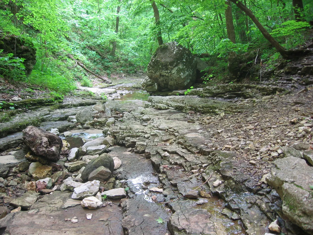

Karst does not mean the entire valley formed when a huge cave roof fell in 1,2,3,4. The Arkansas Grand Canyon is an erosional valley, and the region's common rock shelters formed mostly through weathering and undercutting of cliffs rather than cavern collapse 2,3,4,11. Those shelters also belong to the region's Native history, but their geological origin should not be mistaken for the origin of the whole valley 4,13,14.
The geological maps identify the Red Rock Monocline and the Confederate Fault in the surrounding area 2,3,11. These structures exist, but they did not create the valley as a fault rift 2,3,4,11.
How high is the rim, and how deep is the valley?
USGS terrain modeling gives an elevation of about 1,962 feet at the published Cliff House coordinates, appropriately expressed as about 1,960 feet 15,16. This is a terrain-model estimate, not the elevation of a surveyed benchmark 15,16. Two sampled Dry Branch valley-bottom points have modeled elevations of about 954 feet and 841 feet 17,18. Together, those samples support roughly 1,000 to 1,100 feet of relief between the viewpoint and the selected valley-bottom locations 15,17,18.
A USGS stream gauge on the Left Fork sits at 757 feet, but that is a separate location, not an official measurement of the canyon's deepest point 15,17,18,19. No agency publishes an official maximum depth or width for the Arkansas Grand Canyon, which has no defined boundary 15,17,18.
Related reading
- Where the name came from — tourism language and naming evidence.
- Big Creek and the Buffalo River — follow the watershed.
- Native history — people and bluff shelters.
- Myths and facts — common claims examined.
Sources for this page
Numbers in the text match this list. Bracketed numbers link to the complete source list. Accessed on or before November 3, 2026.
- Encyclopedia of Arkansas, "Boston Mountains" (Margaret J. Guccione) encyclopediaofarkansas.net/entries/boston-mountains-2389/ [13]
- Arkansas Geological Commission: Parthenon geological map geology.arkansas.gov/docs/pdf/maps-and-data/geologic_maps/24k/Parthenon.… [14]
- Arkansas Geological Survey: Mount Judea geological map, revised 2015 geology.arkansas.gov/docs/pdf/maps-and-data/geologic_maps/24k/Mount%20Ju… [15]
- Arkansas Archeological Survey: Geology of Ozark bluff shelters archeology.uark.edu/ozarkbluffshelters/basics/geology/ [16]
- Cliff House Inn: Published coordinates and directions cliffhouseinnar.com/contact/ [1]
- Arkansas Tourism, Arkansas Scenic 7 Byway www.arkansas.com/experiences/discover/attraction-listings/arkansas-sceni… [2]
- USGS National Hydrography Dataset: Large-scale flowlines hydro.nationalmap.gov/arcgis/rest/services/nhd/MapServer/6 [10]
- USGS: Big Creek seepage and dye-tracing data release www.usgs.gov/data/seepage-investigation-and-dye-tracing-characterize-bas… [11]
- USGS GNIS: Big Creek, Left Fork, and both Dry Branch records carto.nationalmap.gov/arcgis/rest/services/geonames/MapServer/6/query?f=… [12]
- University of Arkansas: Sokolosky thesis on Big Creek geochemistry, 2019 scholarworks.uark.edu/cgi/viewcontent.cgi?article=4950&context=etd [27]
- National Park Service, Digital Geologic-GIS Map of Buffalo National River and vicinity (NPS DataStore) irma.nps.gov/DataStore/DownloadFile/680757?Reference=2255898 [29]
- Murdoch, Bitting, and Van Brahana: Boone karst hydrogeology in Big Creek Valley, 2016 link.springer.com/article/10.1007/s12665-016-5981-y [30]
- Beyond Bluff-dwellers archeology.uark.edu/ozarkbluffshelters/people/beyond-bluff-dwellers/ [47]
- Ozark Bluff Dweller Myth encyclopediaofarkansas.net/entries/ozark-bluff-dweller-myth-13214/ [48]
- USGS terrain-elevation estimate at the published Cliff House coordinate epqs.nationalmap.gov/v1/json?x=-93.16241&y=35.94536&units=Feet&wkid=4326… [17]
- USGS: Accuracy and limitations of elevation point queries www.usgs.gov/faqs/how-accurate-are-elevations-generated-elevation-point-… [18]
- USGS terrain-elevation estimate at a selected western Dry Branch point epqs.nationalmap.gov/v1/json?x=-93.13870061544743&y=35.94531851077521&un… [19]
- USGS terrain-elevation estimate at the Dry Branch near Vendor station coordinate epqs.nationalmap.gov/v1/json?x=-93.1129529&y=35.93341086&units=Feet&wkid… [20]
- USGS station metadata for Dry Branch, Left Fork near Vendor, and Big Creek at Carver waterservices.usgs.gov/nwis/site/?format=rdb&sites=07055800,07055792,070… [31]