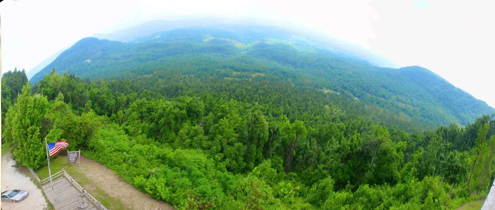

Visiting the Arkansas Grand Canyon means exploring a stretch of roadside valley views on Scenic Highway 7 south of Jasper, not entering a single designated canyon park 2,3,4,5. The Cliff House Inn, Scenic Point and ARDOT's promoted canyon pin are separate locations, and a map label should not be treated as interchangeable with the others 2,3,4,6. Nearby Buffalo National River has no entrance fee, although its campgrounds charge separately 7,8.
Where are the Arkansas Grand Canyon viewpoints?
The Cliff House Inn is the best-known vantage point, on the east side of Highway 7 six miles south of Jasper 4,5. Its published coordinates identify the business, not a surveyed public overlook 4. ARDOT's 2026 Explore AR Highways campaign points to a different stop farther north 2,3.
| Viewpoint | Location and what to know |
|---|---|
| Cliff House Inn | Published business coordinates 35.94536, -93.16241; east side of Highway 7, six miles south of Jasper; private property 4,5. |
| Scenic Point | Commercial lookout tower and gift shop about 2.4 road miles north of the Cliff House area; current hours and fees unverified, checked November 3, 2026 6. |
| ARDOT canyon stop | Campaign map pin at 35.9711119, -93.1684861, distinct from the Cliff House coordinates 2,3. |
Scenic Point existed by April 1960 9, before the early-1970s canyon-name promotion described in Bill Bowden's 2020 Arkansas Democrat-Gazette account 10. Its historic advertising sign described a view “forty miles in Depth and Fifty miles Wide,” but those figures were promotion, not a measured canyon size 11. Read myths and facts before treating old sign figures as dimensions.
There is no formally bounded public “Arkansas Grand Canyon park” with its own hours or fees, and ownership of the public pullouts has not been confirmed 4,5. Do not assume that a roadside viewpoint is a public trailhead or that a commercial tower is freely accessible. Check access directly at the location you intend to use.
Getting there on Scenic Highway 7
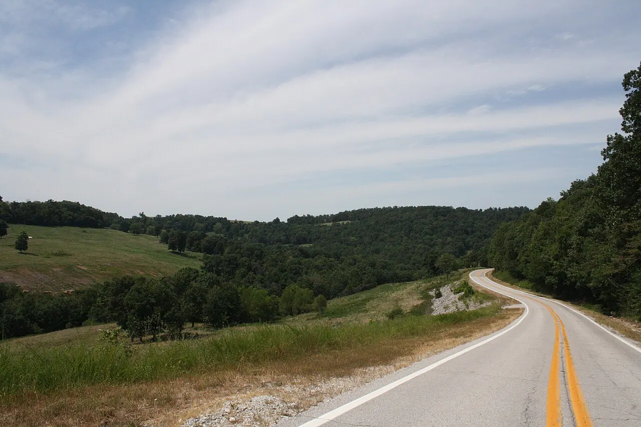
From Jasper, the Cliff House area is about six miles south along Highway 7 4,5. From Harrison, Highway 7 approaches Jasper from the north, crossing the Buffalo River at Pruitt before reaching the town 12,13,14,15,16. From Russellville, Highway 7 provides the northbound corridor toward Pelsor and Jasper 12,13,14,17. These are approaches along the same highway, rather than directions to a separate canyon entrance 4,5.
The road's paving developed in stages: Boone County to Jasper was dedicated in June 1951, and the Pelsor-to-Jasper work is dated to 1955, with a southern dedication photographed September 7, 1956 15,17. Today Highway 7 is a state scenic byway and a National Forest Scenic Byway, two distinct designations 18,19,20. Its road history helps explain why the views and roadside businesses became visitor destinations.
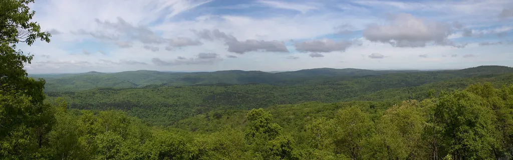
The attraction listings put Pruitt about 11.6 road miles north of the Cliff House area, but give Sam's Throne as about 8.1 miles away in a straight line, not by road 21,22,23. Use a route to the specific destination when planning a day, rather than treating a straight-line distance as driving mileage.
When is the best time to visit?
Morning fog can fill the valley below the rim, a sight documented in a 2021 photograph by Steve Carlton 24. Cool air draining into valleys overnight can create temperature inversions that trap fog below higher ground, but its frequency at the canyon has not been measured 25,26. An early visit offers the possibility of fog, not a guarantee 24,25,26.
Spring brings redbud, dogwood and serviceberry blossoms 27,28. University of Arkansas Extension expects Ozark redbuds to reach full bloom around mid-April, about a week before dogwoods 28. Fall color usually peaks in late October in the Ozarks, with timing affected by elevation, temperature and rainfall 29. The nature and seasons guide offers more context for the forests surrounding the view.
Summers are hot, while winters are relatively short and mild but can still bring snow, ice and severe cold 30,31,32. Winter also offers good opportunities for regional wildlife viewing: eagles are seen most often in winter, and cold spells are among the best times to see elk in Boxley Valley 33,34. Boxley, not the canyon overlook, is the best-established elk-viewing destination 34.
Winter roads and outdoor safety
Check Highway 7 winter conditions on IDrive Arkansas before traveling 35. The January 2009 ice storm is a reminder that a generally mild regional winter can still produce serious weather 30,31,32. Be prepared to change the day's plan if conditions make travel unsafe.
Ticks and chiggers can be active much of the year, and visitors should not approach or feed wildlife 36. Nearby bluff-country outings also require care: the Forest Service identifies bluff hazards at Pedestal Rocks and Kings Bluff 37. Treat the canyon view as a reason to stop and look, not a reason to leave a safe viewing area.
Road access varies between nearby destinations: the National Park Service strongly recommends high-clearance four-wheel drive for Kyles Landing, while Mount Hersey has a rough gravel approach and no drinking water 8,38. Sam's Throne and Whitaker Point also have no drinking water, and Whitaker Point has no restroom 23,39. Consult the things to do guide for the facilities and access details of each outing rather than assuming all attractions have the same services.


Buffalo National River fees and passes
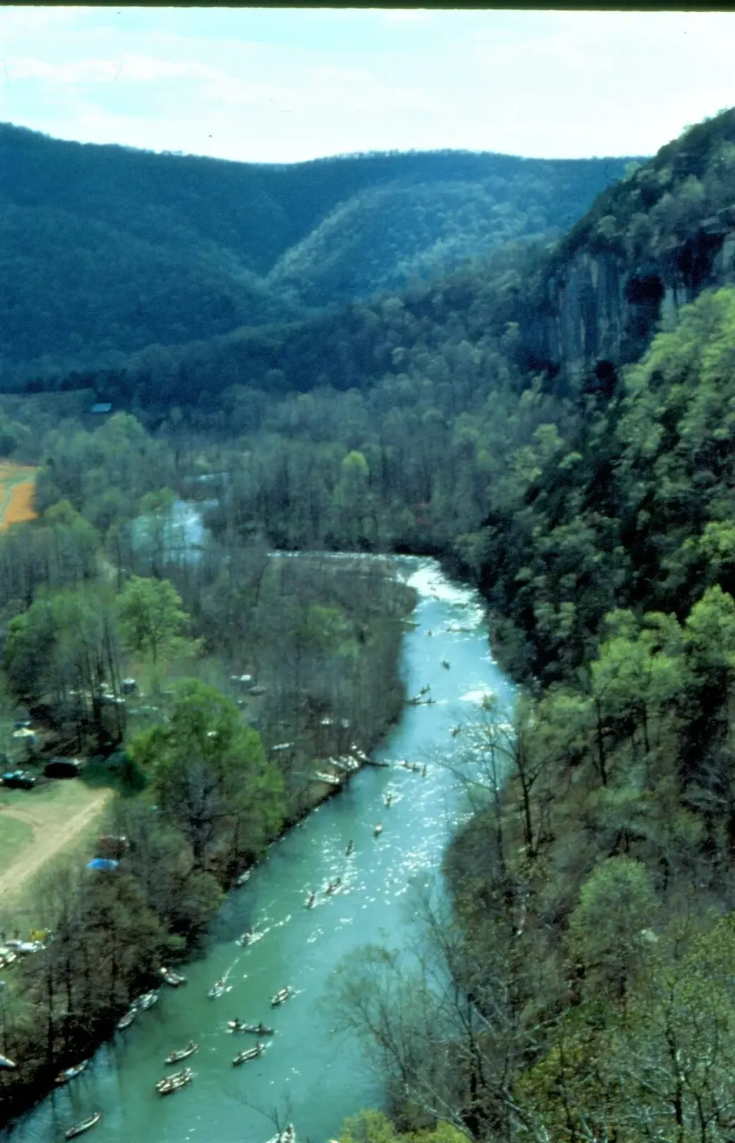
Buffalo National River charges no entrance fee; paid camping is a separate expense 7,8. Checked November 3, 2026, published in-season campground prices include $16 a night at Carver, $20 a night at Ozark Campground and $20 a night at Steel Creek 8,40. Mount Hersey offers free primitive camping, but has no drinking water 38. Check the current campground information before making plans, and confirm any pass or discount question directly before paying.
Upper-river floating depends on rainfall 41. River access and a scenic roadside view are different activities: Pruitt, Hasty and Carver are among the downstream accesses, while the water directly below the Cliff House drains through the Big Creek system rather than the Buffalo's main channel 21,42,43,44. The watershed guide explains that connection.
Visiting responsibly
The Buffalo River region has more than 11,000 years of human history, but that does not establish occupation from every period at the overlook itself 45,46. Archaeological site locations are protected, and digging or collecting artifacts on federal land is a crime 47,48. Leave artifacts where they are and avoid sharing directions or coordinates to sensitive sites. The Native history chapter introduces the regional record without publishing those locations.
For elk viewing in Boxley Valley, park only in designated areas and remain at least 150 feet from elk 49,50. Early morning, evening, fall and cold winter spells are the best-established viewing times 34. Most caves within Buffalo National River are closed to protect bats, with some exceptions 51.
Off-road driving is not allowed inside Buffalo National River 52,53. On nearby national forest land, the Big Piney Motor Vehicle Use Map identifies roads and trails open to particular vehicles; cross-country driving is prohibited and wilderness areas are closed to motor vehicles 54,55. Use the off-roading guide to distinguish private riding properties from national forest routes.
Food, lodging and other services
Jasper's business listings include the Ozark Cafe, Jasper Pizza Company and Peggy Sue's Coffee, while nearby lodging includes Arkansas Grand Canyon View Cabins and Little Switzerland 56,57,58,59,60,61. Compare the food and shops guide and lodging guide before setting out. Confirm opening hours and arrangements directly rather than assuming a listing guarantees service on a particular day.
Related reading
- Things to do — nearby trails, towns and river accesses.
- Nature and seasons — fog, fall color and wildlife.
- Where to stay — lodging options around the canyon.
- Off-roading — riding areas and vehicle rules.
Sources for this page
Numbers in the text match this list. Bracketed numbers link to the complete source list. Accessed on or before November 3, 2026.
- Dameon Hudson, "Scenic view of the Ozark Mountains, Jasper, Arkansas," Wikimedia Commons (CC BY 3.0) commons.wikimedia.org/wiki/File:Scenic_view_of_the_Ozark_Mountains_-_Jas… [244]
- ARDOT, Explore AR Highways www.ardot.gov/explore/ [6]
- ARDOT Launches Public Interactive Quest: Explore AR Highways, October 12, 2026 ardot.gov/news/26-166/ [25]
- Cliff House Inn: Published coordinates and directions cliffhouseinnar.com/contact/ [1]
- Arkansas Tourism, Arkansas Scenic 7 Byway www.arkansas.com/experiences/discover/attraction-listings/arkansas-sceni… [2]
- Scenic Point Gift Shop chamber listing newtoncountychamber.com/directory/scenic-point-gift-shop/ [189]
- Buffalo National River fees and passes www.nps.gov/buff/planyourvisit/fees.htm [187]
- Buffalo National River current campground information www.nps.gov/buff/planyourvisit/camping.htm [188]
- Arkansas State Archives: Scenic Point photograph and 1960 Gazette article references findingaids.digitalheritage.arkansas.gov/repositories/3/archival_objects… [86]
- Bill Bowden, State’s Grand Canyon still a draw, February 3, 2020, PressReader edition www.pressreader.com/usa/arkansas-democrat-gazette/20200203/2817412714065… [3]
- Arkansas State Archives, "Van Kimber, Kimber beside Scenic Point sign," ECD1339-7, Ernie Deane Studio Photograph Collection findingaids.digitalheritage.arkansas.gov/repositories/3/archival_objects… [87]
- CALS: Arkansas Highway 7 encyclopediaofarkansas.net/entries/arkansas-highway-7-14001/ [21]
- CALS: Roads and Highways encyclopediaofarkansas.net/entries/roads-and-highways-4209/ [81]
- Arkansas State Highway Commission, 1924 state highway map (ARDOT map archive) ardot-gis-imagery.s3.us-east-2.amazonaws.com/PLAN/GIS/MAPS/STATE_TOURIST… [82]
- AHPP: Jasper Commercial Historic District tour script, April 12, 2014 www.arkansasheritage.com/docs/default-source/ahpp-documents/sandwiching-… [64]
- CALS: Buffalo River Bridge encyclopediaofarkansas.net/entries/buffalo-river-bridge-16196/ [83]
- Shiloh Museum: Scenes of Newton County shilohmuseum.org/project/scenes-of-newton-county/ [74]
- ARDOT: Scenic Byways ardot.gov/divisions/right-of-way/row_sections/beautification-section/sce… [22]
- National Scenic Byway Foundation: Arkansas Scenic 7 Byway nsbfoundation.com/sb/arkansas-scenic-7-byway/ [93]
- USDA Forest Service: Scenic 7 Byway www.fs.usda.gov/r08/ouachita/recreation/scenic-7-byway [94]
- NPS: River Accesses and Mileage www.nps.gov/buff/planyourvisit/river-accesses-mileage.htm [113]
- NPS: Paddle Ozark to Pruitt www.nps.gov/thingstodo/paddle-ozark-to-pruitt.htm [194]
- Sams Throne Recreation Area www.fs.usda.gov/r08/ozark-stfrancis/recreation/sams-throne-recreation-ar… [204]
- Only in Arkansas: Photo of the Week, Fog Over Arkansas Grand Canyon onlyinark.com/photos/fog-arkansas-grand-canyon/ [130]
- National Weather Service: Mountain and valley fog www.weather.gov/safety/fog-mountain-valley [131]
- NOAA NWS: What is a temperature inversion? www.weather.gov/lmk/inversion [132]
- NPS: Trees and Shrubs www.nps.gov/buff/learn/nature/treesandshrubs.htm [116]
- University of Arkansas Extension: Plant of the Week, Redbud www.uaex.uada.edu/yard-garden/resource-library/plant-week/redbud.aspx [118]
- Arkansas Tourism: Fall Foliage Drives and Destinations Across Arkansas www.arkansas.com/plan-your-trip/plan/trip-ideas-itineraries/fall-foliage… [119]
- NPS: Climate and Geology www.nps.gov/buff/learn/nature/climate-and-geology.htm [134]
- NOAA NWS Little Rock: Climate Data www.weather.gov/lzk/wxcntl3.htm [135]
- NOAA NWS: Ice Storm on January 26–28, 2009 www.weather.gov/lzk/win0109ayr.htm [136]
- NPS: Birds www.nps.gov/buff/learn/nature/birds.htm [125]
- NPS: Elk www.nps.gov/buff/learn/nature/elk.htm [124]
- ARDOT IDrive Arkansas: Winter Weather Road Conditions www.idrivearkansas.com/travel_info/report?report_type=winter&show_tir_bt… [138]
- NPS: Safety www.nps.gov/buff/planyourvisit/safety.htm [139]
- Pedestal Rock Scenic Area www.fs.usda.gov/r08/ozark-stfrancis/recreation/pedestal-rock-scenic-area [198]
- NPS: Paddling Mount Hersey to Woolum www.nps.gov/thingstodo/paddling-mt-hersey-to-woolum.htm [205]
- Whitaker Point Hawksbill Crag Trailhead www.fs.usda.gov/r08/ozark-stfrancis/recreation/whitaker-point-hawksbill-… [208]
- NPS: Paddle Hasty to Carver www.nps.gov/thingstodo/paddle-hasty-to-carver.htm [97]
- NPS: Upper District Paddling www.nps.gov/buff/planyourvisit/upper-district-paddling.htm [114]
- USGS National Hydrography Dataset: Large-scale flowlines hydro.nationalmap.gov/arcgis/rest/services/nhd/MapServer/6 [10]
- USGS: Big Creek seepage and dye-tracing data release www.usgs.gov/data/seepage-investigation-and-dye-tracing-characterize-bas… [11]
- USGS GNIS: Big Creek, Left Fork, and both Dry Branch records carto.nationalmap.gov/arcgis/rest/services/geonames/MapServer/6/query?f=… [12]
- People — Buffalo National River www.nps.gov/buff/learn/historyculture/people.htm [42]
- Timeline — Bluff Shelters of the Arkansas Ozarks archeology.uark.edu/ozarkbluffshelters/people/timeline/ [43]
- Endangered by Looting and Development archeology.uark.edu/ozarkbluffshelters/importance/endangered/ [60]
- ARPA sentencing at Buffalo National River www.nps.gov/orgs/1563/isb-buff-case-update-04212021.htm [61]
- Boxley Valley Cultural Landscape www.nps.gov/articles/000/boxley-valley-500898.htm [209]
- NPS archived elk-viewing safety guidance www.nps.gov/buff/learn/news/safety-tips-for-elk-viewing-in-boxley-valley… [210]
- NPS: Cave and Karst Systems, updated January 2026 www.nps.gov/buff/learn/nature/cave.htm [129]
- Polaris Adventures Compton rental listing adventures.polaris.com/adventure/off-road-rentals-compton-arkansas-P-QB2… [175]
- Buffalo River Off-Road Rentals services www.bransonoffroadrentals.com/buffalo-river [176]
- 2026 Big Piney Ranger District Motor Vehicle Use Map www.fs.usda.gov/media/265902 [179]
- Forest Service Big Piney Ranger District www.fs.usda.gov/r08/ozark-stfrancis/recreation/big-piney-ranger-district [180]
- Ozark Cafe chamber listing newtoncountychamber.com/directory/ozark-cafe/ [215]
- Jasper Pizza Company chamber listing newtoncountychamber.com/directory/jasper-pizza-company/ [216]
- Peggy Sue's Coffee official website www.peggysuescoffee.com/ [217]
- Arkansas Grand Canyon View Cabins homepage www.arkansasgrandcanyonviewcabins.com/ [213]
- Arkansas Grand Canyon View Cabins directions www.arkansasgrandcanyonviewcabins.com/location/ [214]
- Little Switzerland official lodging and location information littleswitzerlandarkansas.com/ [227]