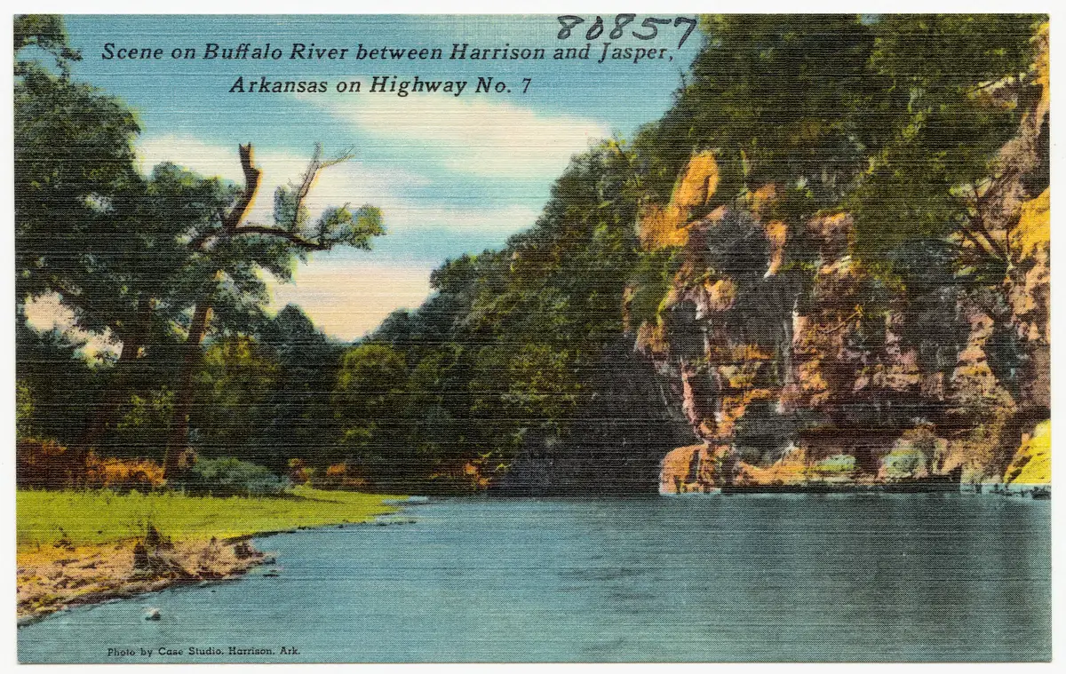

Scenic Highway 7 made the Arkansas Grand Canyon a roadside destination, turning a difficult mountain crossing into Newton County's first paved road from one side of the county to the other 2,3. Paving advanced in stages during the 1950s, with the southern dedication documented on September 7, 1956 2,3. The highway became Arkansas's first state scenic byway in 1993, but its history as a road for travelers, businesses and valley viewpoints began much earlier 2,4,5,6.
Before Highway 7: crossing the Boston Mountains
The Boston Mountains presented a formidable barrier to travel before modern highways; the Encyclopedia of Arkansas describes a time when going from Little Rock to northwest Arkansas through St. Louis was easier than crossing the mountains directly 7. These mountains form the southern portion of the Ozark Plateau, with deeply cut valleys and the greatest valley-to-summit relief of any landform between the Appalachians and the Rockies 7. Their terrain helps explain why building a dependable route mattered so much to Newton County 2,7.
Under the old county road system, local men owed four days of road work each year 2. Highway 7 remained a rough gravel road through the first half of the twentieth century, even after it appeared as part of the developing state network 2,8,9. Its history belongs alongside the settlement history of Newton County, not just the later story of scenic driving 2,3.

How the route developed after 1923
Arkansas's Harrelson Road Law created the state highway system in 1923 8,10. A 1924 state map shows a route roughly following today's Highway 7 between Ola, Russellville, Jasper and Harrison 8,9. A line on that map established a route, not proof that every part had been built to a modern standard or paved 2,8,9.
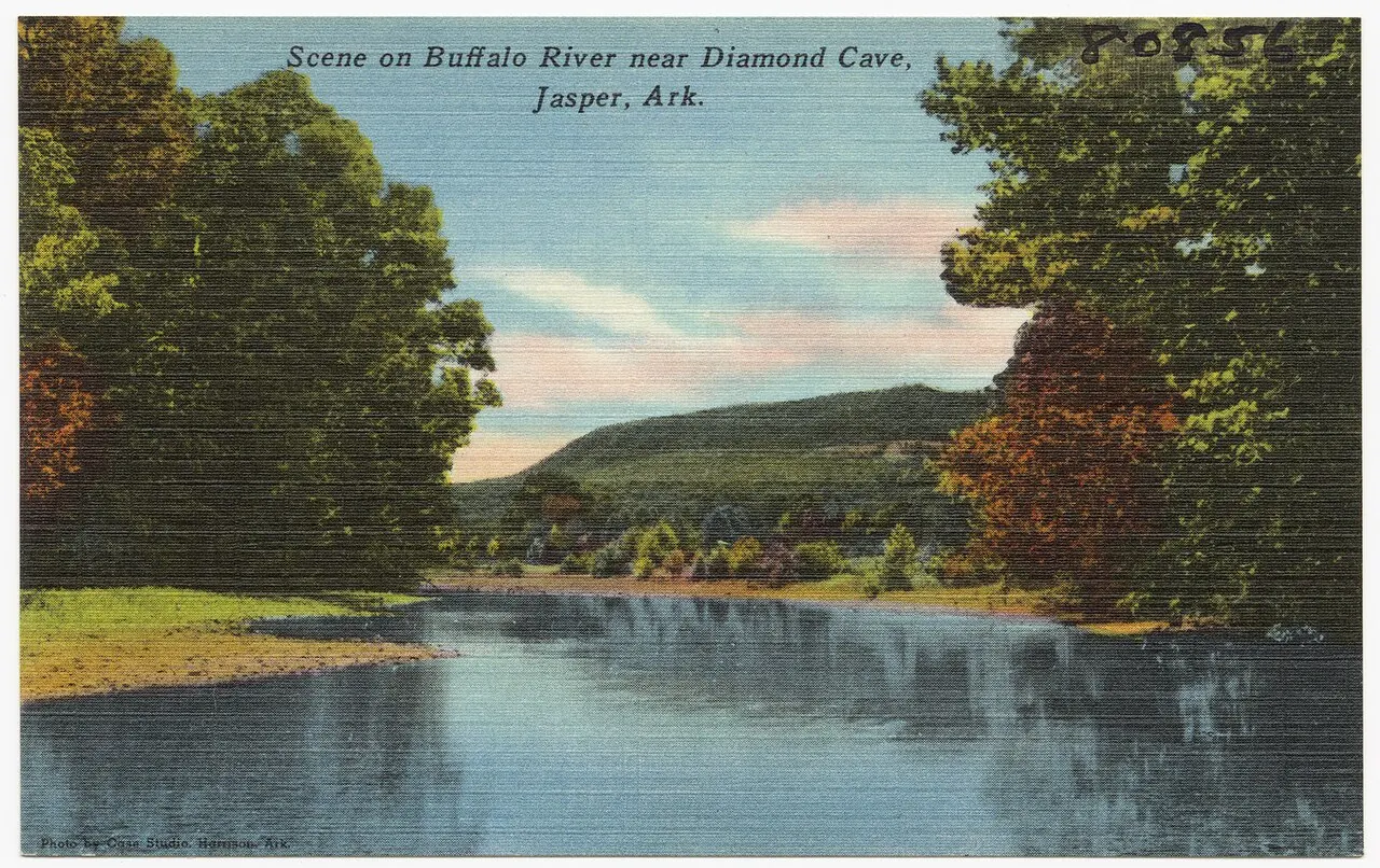
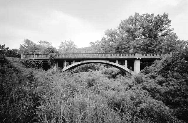
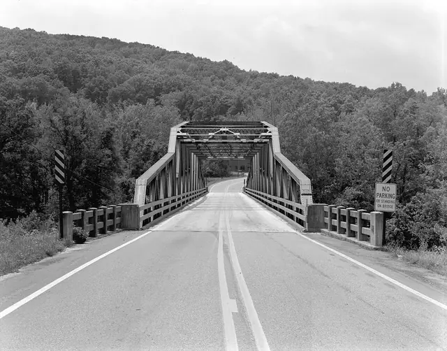
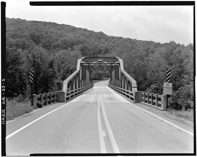
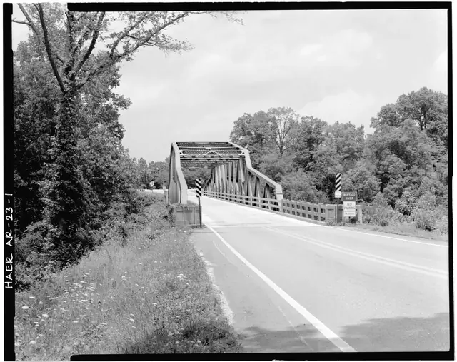
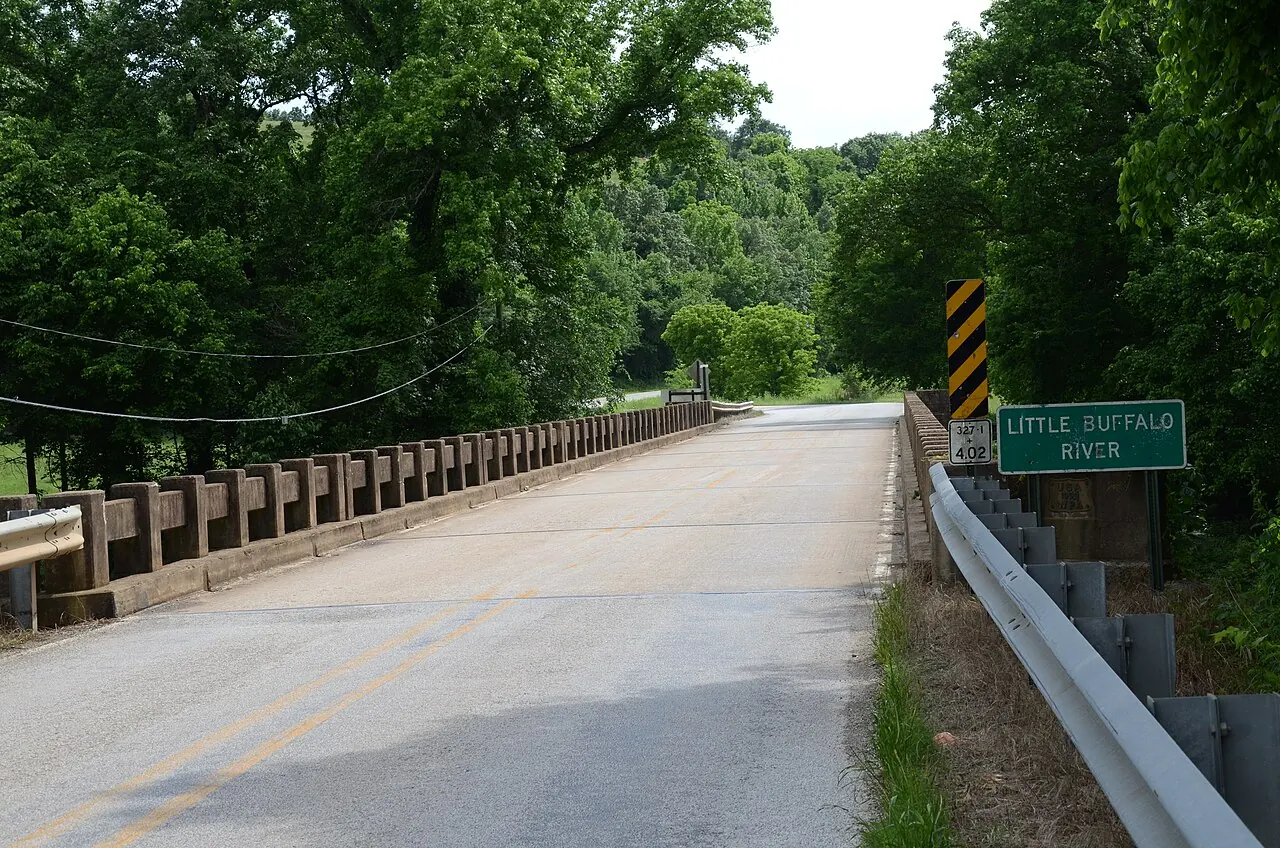
Bridges were important landmarks in the highway's development: Jasper's bridge over the Little Buffalo was built in 1925, and the Highway 7 bridge over the Buffalo River at Pruitt followed in 1931 1,3. These were crossings of two different rivers, neither of which should be confused with the drainage directly below the Arkansas Grand Canyon viewpoint 1,3,11,12,13. The valley seen south of Jasper belongs to Big Creek and its tributaries 11,12,13.



When was Highway 7 paved?
Highway 7's paving was a sequence of projects rather than a single countywide event 2,3. The stretch between Boone County and Jasper was dedicated in June 1951 2. The Arkansas Historic Preservation Program dates the paving between Pelsor and Jasper to 1955, while a Shiloh Museum photograph records the dedication of the southern paving on September 7, 1956 2,3. The paving date and the ceremony date describe different stages of the same development, not competing dates for a single event 2,3.
| Date | Highway milestone |
|---|---|
| 1923 | The Harrelson Road Law creates Arkansas's state highway system 8. |
| 1924 | A state map shows a route roughly along today's Highway 7 between Ola, Russellville, Jasper and Harrison 8,9. |
| June 1951 | Paving between Boone County and Jasper is dedicated 2. |
| 1955 | The Arkansas Historic Preservation Program dates Pelsor-to-Jasper paving to this year 3. |
| September 7, 1956 | A Shiloh Museum photograph documents the southern paving dedication 2. |
| 1993 | Highway 7 becomes Arkansas's first state scenic byway 4. |
| 1999 | The state scenic designation extends south to the Louisiana line 4. |
The completed route was the first paved road to cross the whole county 2,3. It brought tourists and new businesses, but the benefits were uneven: communities bypassed by the road, including Lurton, lost some of the activity that had supported them 2,3. Highway improvement changed both how visitors reached the mountains and which communities they passed through 2,3.
Scenic Point and the selling of the view
Scenic Point, a commercial lookout tower and gift shop north of the Cliff House Inn, existed by April 1960 5,6. Its old sign, preserved in an Arkansas State Archives photograph, announced an altitude of “2169 ft.” and described the view as “forty miles in Depth and Fifty miles Wide,” containing “One Million two hundred and Eighty thousand acres of land” 15. Those figures are historical advertising claims, not verified measurements of the Arkansas Grand Canyon 15.
The sign is useful evidence of how roadside tourism presented the landscape, but it cannot establish the canyon's dimensions 15. The Arkansas Grand Canyon is a tourism name for a stretch of valley views south of Jasper, rather than one formally defined geographic feature 16,17,18,19,20. The history of the name explains why a promotional label and an official place-name record are different things 18,19,20,21.
Booger Hollow, Dogpatch and roadside attractions
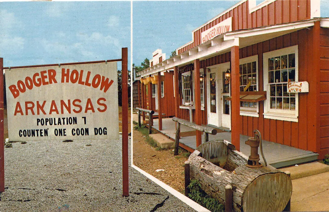
Booger Hollow Trading Post operated on the Highway 7 corridor from 1961 to 2004 5,22.

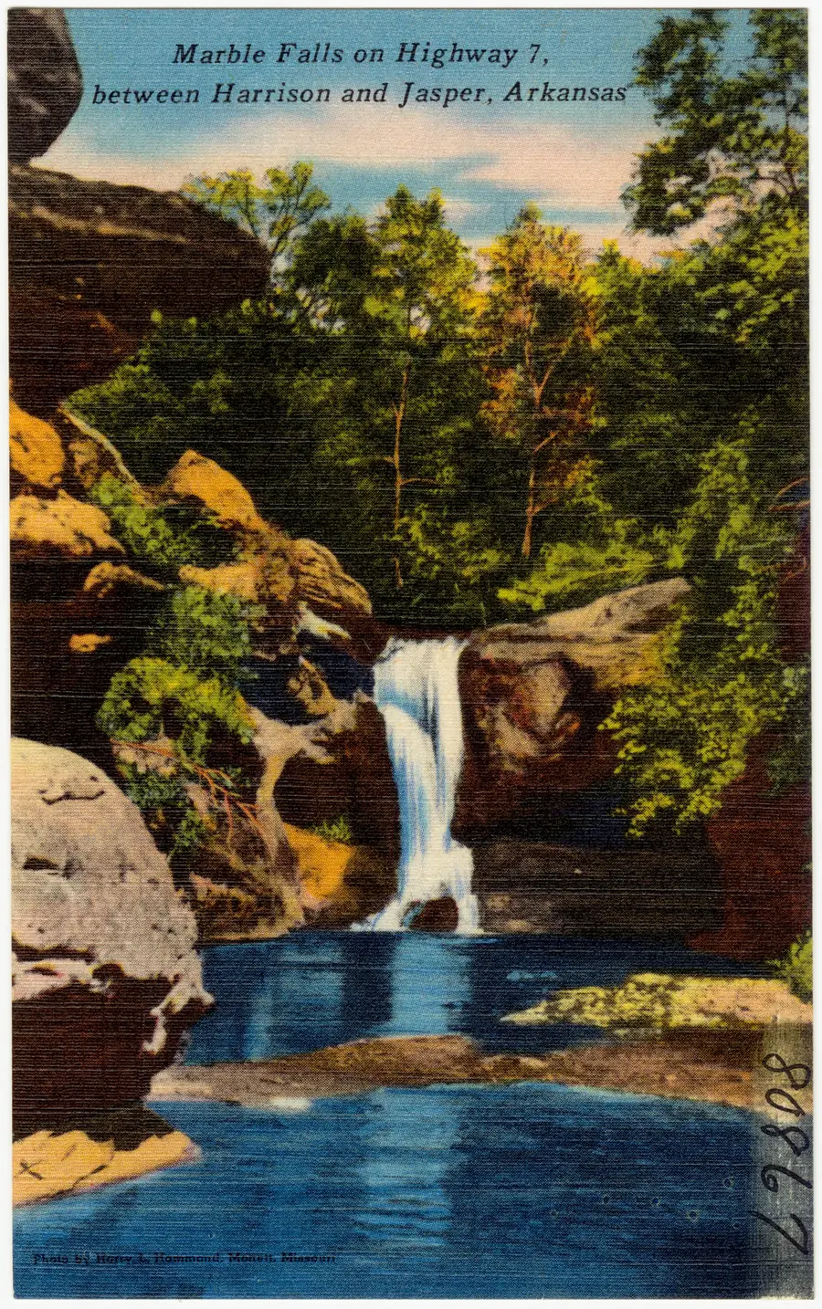
Near Marble Falls, Dogpatch USA offered a different kind of attraction: a theme park based on the “Li'l Abner” comic strip, open from 1968 to 1993 14. Management claimed 300,000 visitors during its first year, but that figure was unaudited and should be understood as the park's own claim 14.
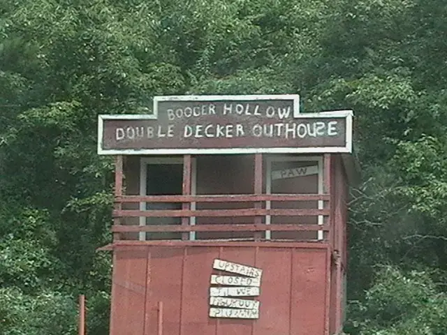

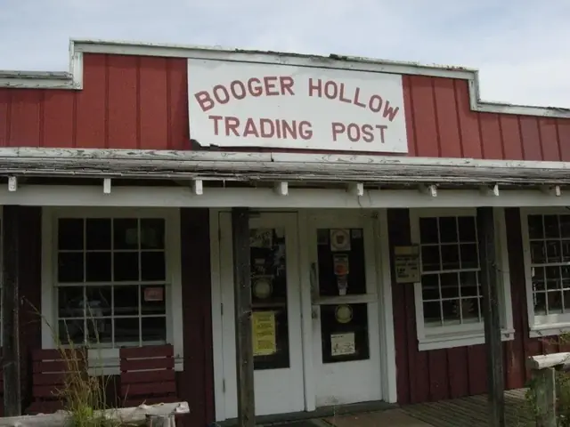

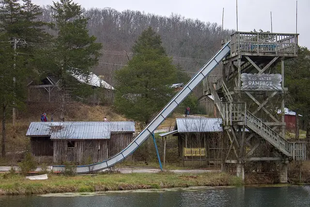

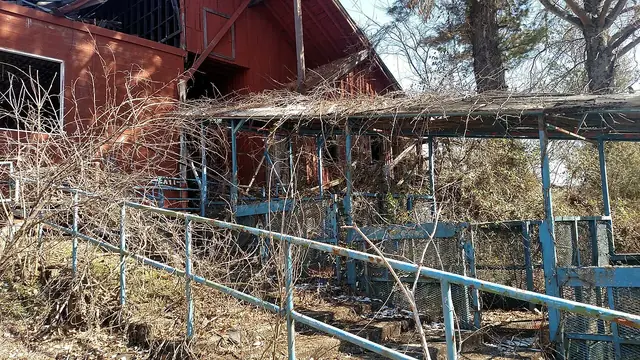


Bass Pro Shops founder Johnny Morris bought the former Dogpatch property in 2020 and announced plans for a nature park 23. Reporting in June 2026 still described the project as under development 24. Status checked November 3, 2026: the former theme-park property is private and not open to the public; the historic Dogpatch attraction should not be treated as an operating destination 14,23. Mystic Caverns, south of Harrison, was reported closed in November 2021, with no verified reopening as of the November 3, 2026 status check 25.

Rotary Ann is a different valley overlook
Rotary Ann roadside park, south of Pelsor, developed in the 1930s after the wives of Russellville Rotarians, known as “Rotary Anns,” advocated for it 5,26. The Forest Service and state highway department cooperated in the project 5,26. A June 23, 2003 newspaper report, citing a Forest Service release, called Rotary Ann Arkansas's first rest area and documented its reconstruction that year 26.
Rotary Ann overlooks the Big Piney Creek valley, not the Arkansas Grand Canyon's Big Creek drainage 5,11,12,13. Similar valley views along the same highway do not make the two locations interchangeable 5,16,17.
What did the 1993 scenic designation mean?
Highway 7 became Arkansas's first state scenic byway in 1993, not 1994 4. Its designation was extended south to the Louisiana line in 1999, and the designated route runs about 290 miles to Harrison 4,27.
The highway is also a National Forest Scenic Byway under a separate Forest Service program 27,28. That designation is not the federal National Scenic Byways program, so the state and national-forest recognitions should be named accurately 27,28.

Highway 7's motorcycle reputation
Motorcycle Classics featured Highway 7 in 2007 29. Rider magazine's 2024 list of the best motorcycle roads included the “Jasper Disaster,” a loop using Highways 7, 43 and 74 rather than Highway 7 alone 30. The list was unranked, so it does not support the frequently repeated claim that Highway 7 placed “number two in the nation” 30.
The distinction matters: recognition of a three-highway loop is real, while a national second-place ranking is unconfirmed 30. More corrections to familiar travel claims appear in myths and facts.
Driving Highway 7 today
ARDOT launched its Explore AR Highways campaign on October 12, 2026, including “Arkansas' Grand Canyon” as a Highway 7 selfie stop 31,32. Its mapped point is different from the inn's published coordinates; Scenic Point is another distinct location 5,6,16,31,32. The canyon is best understood as a stretch of roadside views, not one pin that represents every lookout 16,17,31,32.
The highway's river crossings have changed since the early road era: Jasper's 1925 Little Buffalo bridge was replaced in 1975, and the replacement Pruitt bridge opened on May 14, 2021 1,3. The old Pruitt bridge was taken down that June 1.

In winter, consult IDrive Arkansas's winter road conditions before traveling Highway 7 33. Snow and ice occur despite the region's relatively short, mild winters 34,35,36. Use the visiting guide and nature and seasons page to plan the rest of the trip.
Related reading
- Settlement history: communities around the road.
- The canyon's name: tourism and place names.
- Big Creek and the Buffalo River: the watershed below.
- Cliff House Inn: a roadside landmark.
- Historical timeline: events in sequence.
Sources for this page
Numbers in the text match this list. Bracketed numbers link to the complete source list. Accessed on or before November 3, 2026.
- CALS: Buffalo River Bridge encyclopediaofarkansas.net/entries/buffalo-river-bridge-16196/ [83]
- Shiloh Museum: Scenes of Newton County shilohmuseum.org/project/scenes-of-newton-county/ [74]
- AHPP: Jasper Commercial Historic District tour script, April 12, 2014 www.arkansasheritage.com/docs/default-source/ahpp-documents/sandwiching-… [64]
- ARDOT: Scenic Byways ardot.gov/divisions/right-of-way/row_sections/beautification-section/sce… [22]
- Joe David Rice: The Long and Winding Road, August 1, 2024 aymag.com/long-winding-road/ [85]
- Arkansas State Archives: Scenic Point photograph and 1960 Gazette article references findingaids.digitalheritage.arkansas.gov/repositories/3/archival_objects… [86]
- Encyclopedia of Arkansas, "Boston Mountains" (Margaret J. Guccione) encyclopediaofarkansas.net/entries/boston-mountains-2389/ [13]
- CALS: Arkansas Highway 7 encyclopediaofarkansas.net/entries/arkansas-highway-7-14001/ [21]
- Arkansas State Highway Commission, 1924 state highway map (ARDOT map archive) ardot-gis-imagery.s3.us-east-2.amazonaws.com/PLAN/GIS/MAPS/STATE_TOURIST… [82]
- CALS: Roads and Highways encyclopediaofarkansas.net/entries/roads-and-highways-4209/ [81]
- USGS National Hydrography Dataset: Large-scale flowlines hydro.nationalmap.gov/arcgis/rest/services/nhd/MapServer/6 [10]
- USGS: Big Creek seepage and dye-tracing data release www.usgs.gov/data/seepage-investigation-and-dye-tracing-characterize-bas… [11]
- USGS GNIS: Big Creek, Left Fork, and both Dry Branch records carto.nationalmap.gov/arcgis/rest/services/geonames/MapServer/6/query?f=… [12]
- CALS: Dogpatch USA encyclopediaofarkansas.net/entries/dogpatch-usa-2302/ [89]
- Arkansas State Archives, "Van Kimber, Kimber beside Scenic Point sign," ECD1339-7, Ernie Deane Studio Photograph Collection findingaids.digitalheritage.arkansas.gov/repositories/3/archival_objects… [87]
- Cliff House Inn: Published coordinates and directions cliffhouseinnar.com/contact/ [1]
- Arkansas Tourism, Arkansas Scenic 7 Byway www.arkansas.com/experiences/discover/attraction-listings/arkansas-sceni… [2]
- USGS, Download GNIS Data www.usgs.gov/us-board-on-geographic-names/download-gnis-data [7]
- USGS Arkansas DomesticNames extract, modified November 2, 2026 prd-tnm.s3.amazonaws.com/StagedProducts/GeographicNames/DomesticNames/Do… [8]
- USGS national AllNames official and variant-name extract, modified November 2, 2026 prd-tnm.s3.amazonaws.com/StagedProducts/GeographicNames/Topical/AllNames… [9]
- Bill Bowden, State’s Grand Canyon still a draw, February 3, 2020, PressReader edition www.pressreader.com/usa/arkansas-democrat-gazette/20200203/2817412714065… [3]
- Arkansas State Archives: Booger Holler Trading Post, June 10, 1964 findingaids.digitalheritage.arkansas.gov/repositories/3/archival_objects… [88]
- Bass Pro Shops newsroom, Johnny Morris committed to preserve historic Dogpatch property about.basspro.com/newsroom/stories/noted-conservationist-and-bass-pro-sh… [90]
- David Peterson: Marble Falls Nature Park... Someday?, June 7, 2026 www.ozarksociety.net/2026/06/marble-falls-nature-park-someday/ [91]
- Julie Kohl: Arkansas Caves, August 2022 onlyinark.com/featured/arkansas-caves/ [92]
- The Courier: Rotary Ann rest area being reconstructed, June 23, 2003 www.couriernews.com/local_news/rotary-ann-rest-area-the-first-in-arkansa… [84]
- National Scenic Byway Foundation: Arkansas Scenic 7 Byway nsbfoundation.com/sb/arkansas-scenic-7-byway/ [93]
- USDA Forest Service: Scenic 7 Byway www.fs.usda.gov/r08/ouachita/recreation/scenic-7-byway [94]
- Landon Hall: Destinations: Arkansas' Highway 7, July 18, 2007 www.motorcycleclassics.com/classic-motorcycle-touring/arkansas-highway-s… [95]
- Rider: 50 Best Motorcycle Roads in America, December 17, 2024 ridermagazine.com/50-best-motorcycle-roads-in-america/ [96]
- ARDOT, Explore AR Highways www.ardot.gov/explore/ [6]
- ARDOT Launches Public Interactive Quest: Explore AR Highways, October 12, 2026 ardot.gov/news/26-166/ [25]
- ARDOT IDrive Arkansas: Winter Weather Road Conditions www.idrivearkansas.com/travel_info/report?report_type=winter&show_tir_bt… [138]
- NPS: Climate and Geology www.nps.gov/buff/learn/nature/climate-and-geology.htm [134]
- NOAA NWS Little Rock: Climate Data www.weather.gov/lzk/wxcntl3.htm [135]
- NOAA NWS: Ice Storm on January 26–28, 2009 www.weather.gov/lzk/win0109ayr.htm [136]